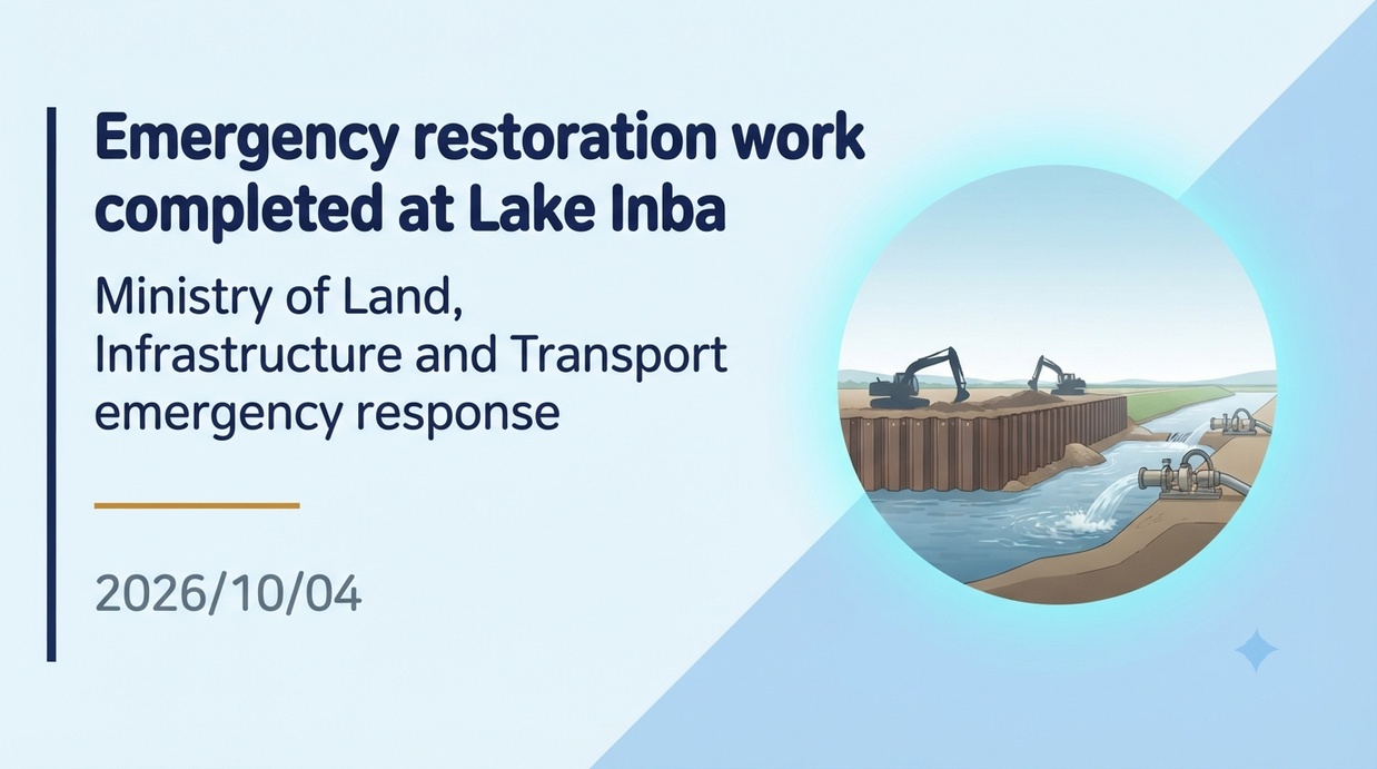
The Kanto Regional Development Bureau of the Ministry of Land, Infrastructure, Transport and Tourism, alongside Chiba Prefecture and other entities, has completed emergency closure work on the breached Inbanuma levee, which collapsed due to torrential rains from Reiwa 8 Typhoon No. 25, thereby blocking the floodwaters prior to the approach of Typhoon No. 26. Behind this lies the capacity limits of the existing flood control infrastructure completed in Showa 43 (1968) and excessive flooding on soft ground, creating a demand for a fundamental restructuring of flood control measures that goes beyond mere levee raising.
- Levee Breach for the First Time in 57 Years and Completion of Emergency Closure Before Typhoon No. 26
- The Reality of Inundation Damage and Infrastructure Disruption Caused by Compound Disasters
- The maximum water level of 5.04 meters that exceeded the planned high water level and ground vulnerability
- Functional Limits of the Dual Drainage System and the Backwater Phenomenon
- Flood Control Shift Aimed at Levee Reinforcement and Enhanced Wide-Area Water Storage Capacity
- Progress of Double-Wall Cofferdam Construction and Key Points to Monitor in Watershed Flood Management
Levee Breach for the First Time in 57 Years and Completion of Emergency Closure Before Typhoon No. 26
On September 22, 2026, record-breaking heavy rain brought by a large and powerful Typhoon No. 25 caused the eastern embankment of the North Imba Marsh, located off the Funagata reclamation area in Narita City, Chiba Prefecture, to breach over a length of approximately 100 meters. This levee failure at Imba Marsh was an unprecedented disaster, marking the first time a levee has collapsed in 57 years, since the start of integrated management in 1969 (Showa 44). In response to this emergency, Chiba Prefecture requested technical assistance from the Ministry of Land, Infrastructure, Transport and Tourism (MLIT), and formed a joint support framework called “Team Imba Marsh.” The team consisted of the TEC-FORCE (Technical Emergency Control Force) of the MLIT Kanto Regional Development Bureau, the Japan Water Agency, and Kajima Corporation, a contractor appointed through an emergency negotiated contract. At the site, round-the-clock construction was implemented, executing rough cofferdam work that involved deploying 1-ton water-resistant sandbags, crushed stone, rocks, and sheets. On October 1, 2026, Chiba Prefecture Governor Toshihito Kumagai reported that the closure of the breach had been completed just before the next threat, Typhoon No. 26, approached the Kanto region. Rapid restoration work was deployed on-site to prevent the further spread of flood damage.
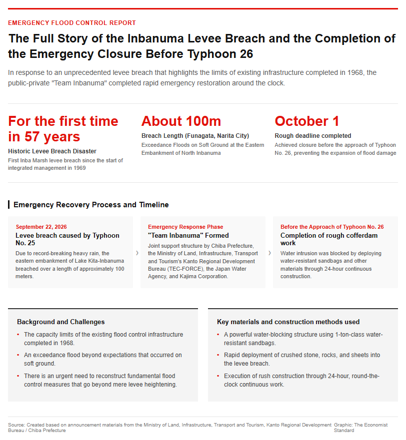
With the completion of the emergency measures, a water-retaining function capable of accommodating water level rises up to the existing planned high-water level of 4.25 meters in elevation (Y.P. equivalent) has been temporarily secured.
The Reality of Inundation Damage and Infrastructure Disruption Caused by Compound Disasters
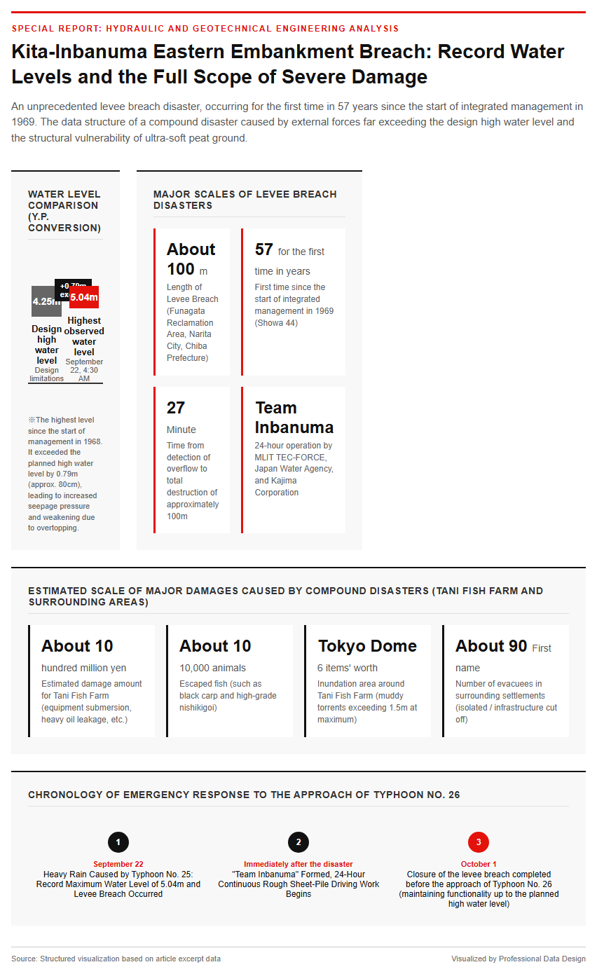
The recent levee breach inflicted massive economic and social damage on the surrounding areas. Widespread flooding above and below floor levels occurred in the lowland areas of the Funagata reclaimed land in Narita City, Sakae Town in Imba District, and Inzai City, completely submerging numerous paddy fields just before the harvest season. Furthermore, a chain of levee breaches occurred along the Kakugawa River (located in Shimohata, Narita City), an agricultural drainage channel flowing into the North Imba Marsh, and the Nagatogawa River (located in Sakana, Sakae Town), an outflow river, expanding the scale of the damage. At Tani Fish Farm in Narita City, a 65-year-old business, muddy torrents exceeding 1.5 meters in height rushed into the premises located about 500 meters away from the breach site. The inundated area was equivalent to six Tokyo Domes. In addition to submerged facilities and heavy oil leakage, about 100,000 fish—including 170-centimeter-long black carp and high-grade nishikigoi—were washed away, bringing estimated damages to approximately 1 billion yen. The blow to transportation infrastructure was also severe, as the area around the Kitasuka Intersection on the Kita-Chiba Road (National Route 464), a regional arterial highway, was completely submerged and closed to all traffic, temporarily cutting off wide-area distribution and emergency transport networks. Surrounding settlements were isolated, and about 90 people were forced to evacuate, casting a serious shadow over local community life.
Decoding the Mechanism of Levee Breaches through Hydraulic and Geotechnical Engineering
The maximum water level of 5.04 meters that exceeded the planned high water level and ground vulnerability
The direct cause of the levee breach was a combination of unprecedented, record-breaking external forces and the structural vulnerability of the foundation ground. At 4:30 a.m. on September 22, 2026, the water level of North Inba-numa reached an elevation of 5.04 meters (on a Y.P. basis), the highest level recorded since management began in 1968. This was an extreme flood, exceeding the planned high water level of 4.25 meters—the design limit of the levee—by 0.79 meters (approximately 80 centimeters). The levees around Inba-numa are built directly on top of ultra-soft cohesive soils and peat layers formed during the Jomon transgression period. Because peat ground has a high water content and extremely high compressibility, long-term consolidation settlement and differential settlement had been progressing over several decades. As a result, the levee crest height locally fell below design standards, degrading its protective functions. The sustained high water level caused the rapid progression of piping phenomena driven by increased seepage pressure and the erosion of the landside slope. Furthermore, when water began to overtop the crest, the earthen levee containing non-cohesive silt could not withstand the flow velocity of the overtopping water, resulting in a brittle failure that caused it to collapse over a length of approximately 100 meters just 27 minutes after the overtopping was detected.
Functional Limits of the Dual Drainage System and the Backwater Phenomenon
The flood control structure of Lake Inba relies on the “North-South dual-system decentralized drainage model” completed in 1968 (Showa 43). It is designed to perform mechanical forced drainage of 212 cubic meters per second by combining the northern Inba Drainage Pump Station (toward Narita City and the Tone River, with a maximum drainage capacity of 92 cubic meters per second) and the southern Owada Drainage Pump Station (toward Yachiyo City and Tokyo Bay, with a maximum drainage capacity of 120 cubic meters per second). However, in the recent torrential rains, the inflow from the basin (total area of approximately 494 square kilometers) reached several hundred tons per second, vastly exceeding the pumps’ maximum processing capacity. In addition, because the water level of the main Tone River—the discharge destination—rose sharply, the Ajiki Sluice Gate and Sakaona Sluice Gate had to be fully closed to prevent backflow, significantly impeding both natural drainage and pump drainage to the north. As a result, a backwater phenomenon occurred where a massive volume of water unable to escape northward rushed southward via the Inba Diversion Channel, causing water pressure to spike abnormally across the entire lake. Furthermore, the fact that land reclamation had reduced the lake’s surface area from approximately 2,900 hectares prior to development down to about 1,155 hectares stripped away flood retention capacity, serving as a factor that dramatically accelerated the rate of water level rise.
Reiwa Era Inba Marsh Fundamental Flood Control Project and Future Prospects
Flood Control Shift Aimed at Levee Reinforcement and Enhanced Wide-Area Water Storage Capacity
Following the completion of the emergency measures, Chiba Prefecture Governor Toshihito Kumagai expressed his intention to urge the national government to consider a “Reiwa-era drastic flood control project for Lake Inbanuma,” in light of the embankment breach that occurred for the first time in half a century. Amid an increase in localized heavy rainfall, such as linear precipitation bands driven by climate change, there are limits to flood control measures that simply raise the height of conventional earthen levees. Shifting the flood control paradigm from “line defense” to “basin-wide flood control” is considered an urgent priority. Specific examples include structural improvements to create “overflow-resistant levees (resilient levees)”—which reinforce the levee crown and landside slope with concrete or sheets to prevent collapse even during overtopping—and enhancing water-impermeability by driving steel sheet piles into the ground. Furthermore, rather than relying solely on draining Lake Inbanuma by itself, regional-scale initiatives have become indispensable for the 13 municipalities within the basin, alongside the national and prefectural governments, to work as one to enhance rainwater retention capacity through measures such as advanced pre-drainage in the upper basin, the restoration of water retention functions in traditional yatsu wetlands, and smart management of “paddy field dams” utilizing agricultural land.
Progress of Double-Wall Cofferdam Construction and Key Points to Monitor in Watershed Flood Management
The currently completed rough cofferdam work is merely an emergency temporary measure using stones and sheets to prevent secondary disasters such as the approaching Typhoon No. 26. The Kanto Regional Development Bureau of the Ministry of Land, Infrastructure, Transport and Tourism and Chiba Prefecture are advancing 24-hour construction of the “double steel sheet pile cofferdam work”—which involves driving steel sheet piles in double layers to serve as a reliable temporary cofferdam embankment for full restoration—with the goal of completion by November 22, 2026. This double cofferdam work enhances structural stability against external water pressure, building a foothold for full-scale embankment restoration work. Key points to watch moving forward include the adoption of the national project (disaster restoration project) for full restoration and construction progress, alongside the establishment of real-time flood forecasting protocols responding to the hydrological conditions of downstream urban areas and the entire Tone River water system. Furthermore, given the characteristics of the reclaimed land as a closed low-lying area where natural drainage of intruded water is impossible, it remains crucial to maintain a responsive deployment system for large-scale drainage pump trucks and to continually update protocols for rapidly transmitting evacuation information to residents.
Reference Page
- [Emergency restoration work on the Inbanuma levee will begin] https://www.ktr.mlit.go.jp/kisha/kyoku_s_kisha_00578.pdf
- [Regarding the Levee Breach of Northern Inbanuma] https://www.pref.chiba.lg.jp/kendosei/press/2026/kitainba.html
- [Operational Setup in Response to the Approach of Typhoon No. 25 (Support)] https://www.ktr.mlit.go.jp/saigai/kyoku_dis00001050.html
【#LakeInba #FloodDamage #FloodControl #MLIT #ChibaPrefecture #DisasterPrevention】


コメント